
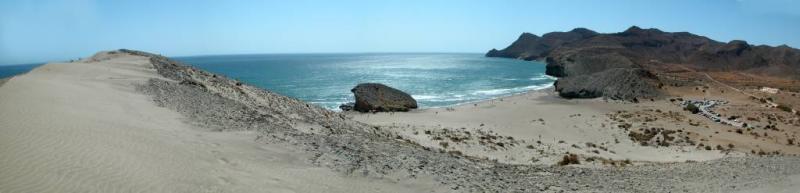
Una vez mas podemos sentirnos orgullosos de visitar este hermoso enclave natural, ya que, Cabo de Gata-Níjar es el primer Parque Natural Terrestre-Marítimo de Andalucía y el segundo Geoparque Español. Las extremas condiciones climáticas de Cabo de Gata unido a los materiales volcánicos (negros) y dunas fósiles (blancas) han cautivado a gran número de fotógrafos, por poner un ejemplo.
Recordemos que cuenta con 375 kilómetros cuadrados de espacio terrestre y 120 kilómetros cuadrados de zona marítima. Con cerca de 60 kilómetros de línea de costa, es uno de los ejemplos mejor preservados de litoral virgen del Mediterráneo con una mínima intervención humana.
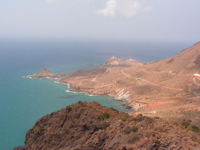
A la vez representa uno de los mejores ejemplos de vulcanismo fósil Neógeno en el sudeste de la península Ibérica y nos permite andar por un museo al aire libre salpicado con calderas y domos volcánicos, disyunciones columnares, flujos de lava, playas y arrecifes fósiles, etc. que nos permiten reconstruir la historia reciente del Mediterráneo.
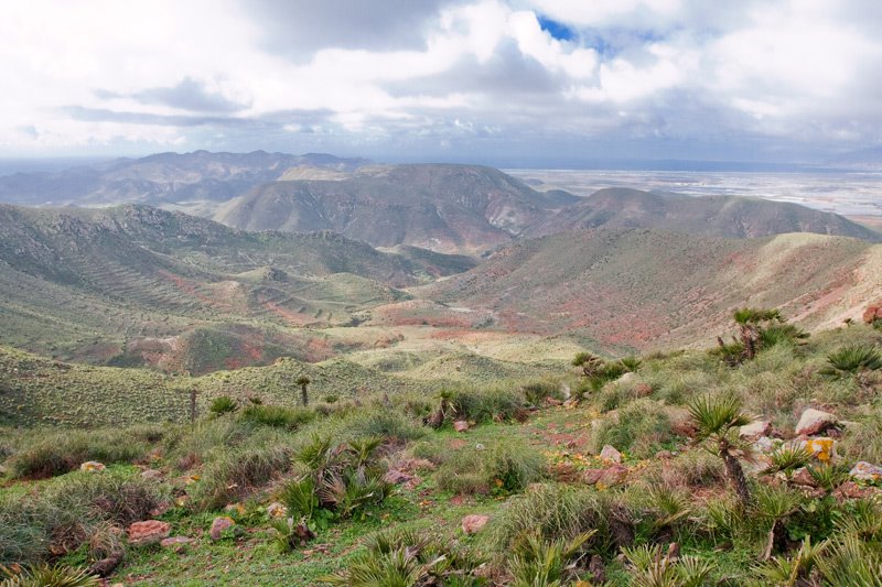
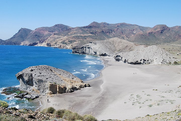
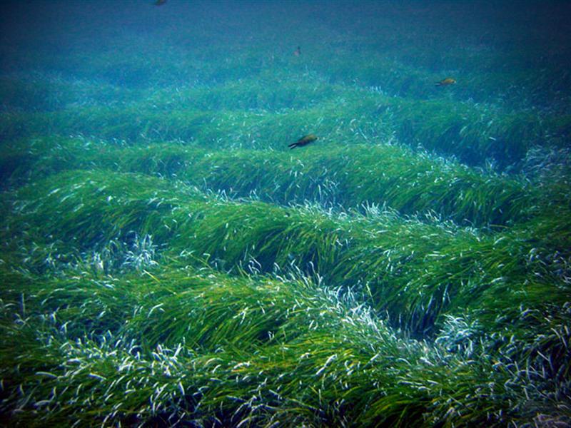
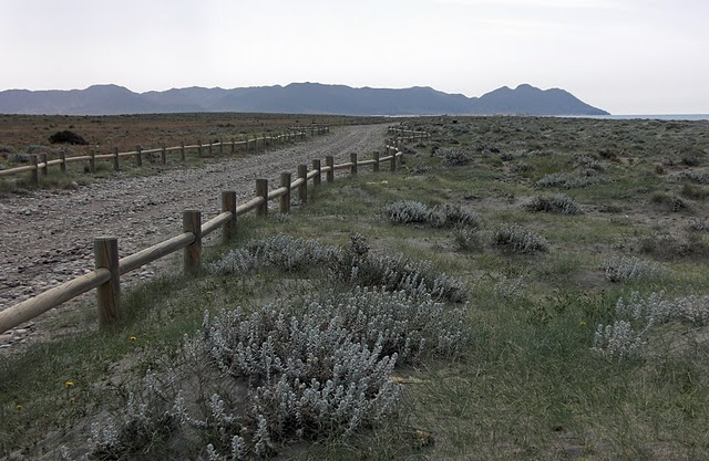
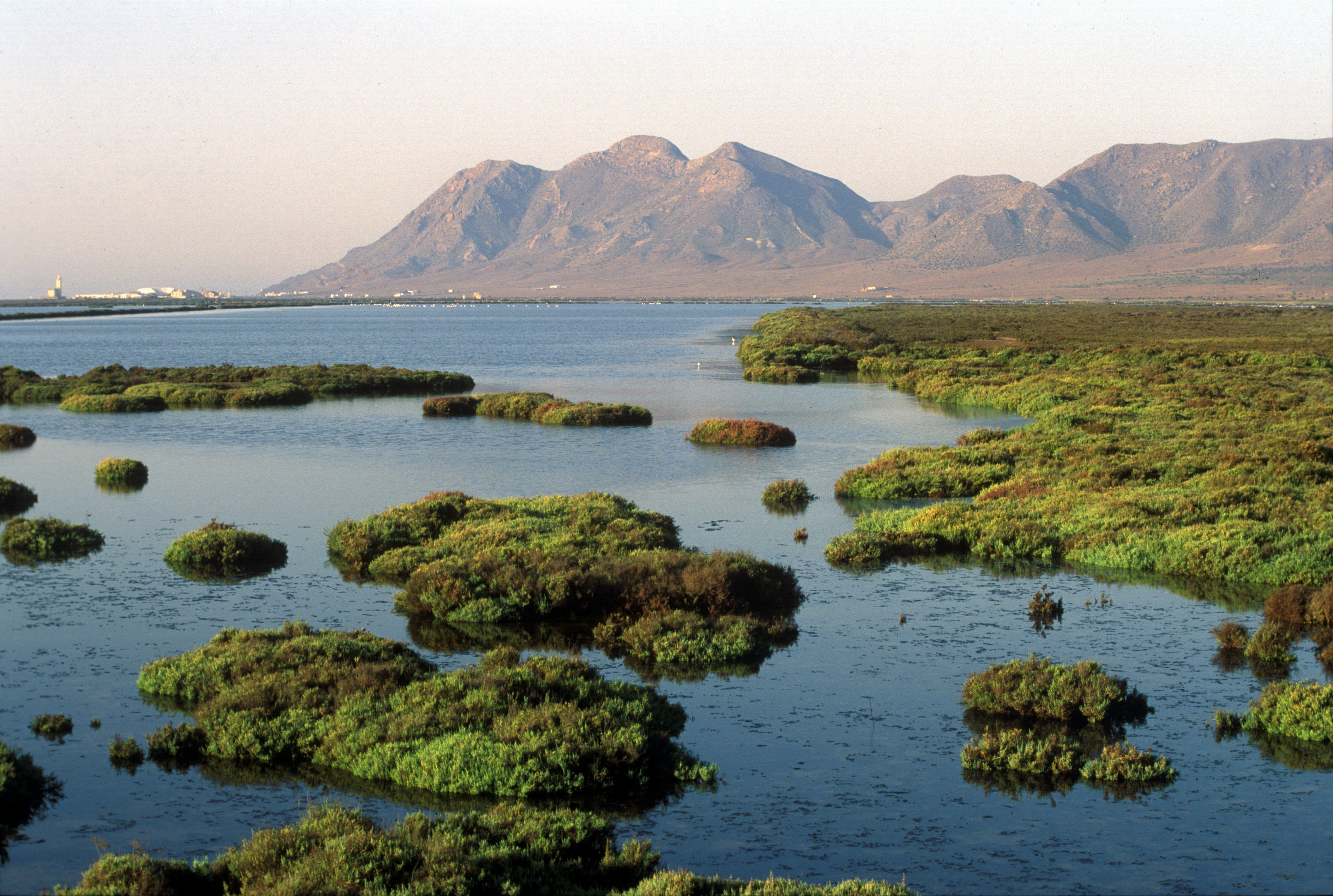
Así, la importancia ecológica del Parque Natural Cabo de Gata-Níjar se encuentra en su origen, de naturaleza volcánica, clima semiárido, de condiciones extremas de viento y oleaje que seleccionan hábitats de gran interés con especies animales y vegetales muy especializadas : estepa mediterránea, formaciones dunares, salinas, acantilados litorales y praderas de fanerógamas marinas (posidonia).
Posee un impresionante marco geológico y natural que ha dado como resultado un área merecedora de numerosos reconocimientos internacionales tales como Reserva de la Biosfera, Humedal de importancia internacional (RAMSAR), Zona de Especial Protección para las Aves, Zona de Especial Interés del Mediterráneo, Lugar de Interés Comunitario y, finalmente, Geoparque Europeo y Global por la UNESCO.
INTRODUCCIÓN:
¿Qué es un Geoparque?: Familiaricémonos con el concepto.
Un territorio protegido…
Un Geoparque Europeo es un territorio que incluye un determinado patrimonio geológico y una estrategia sostenible de desarrollo territorial.
…con un gran patrimonio geológico…
Un Geoparque Europeo debe comprender un cierto número de sitios geológicos de particular importancia en función de su calidad científica, rareza, apariencia estética o valor educacional. La mayoría de los sitios presentes en el territorio de un Geoparque Europeo deben formar parte del Patrimonio Geológico, pero su interés puede ser también arqueológico, ecológico, geoturístico o cultural.
… que es usado para apoyar un desarrollo sostenible.
Los sitios goloógicos en un Geoparque Europeo deben estar vinculados dentro de una red y beneficiarse de medidas de protección y gestión para poder promover y desarrollar actividades educativas, geoturísticas y de desarrollo local.
Así que, un Geoparque es un área geográfica donde el patrimonio geológico es parte de un concepto holístico que incluye la conservación, educación y desarrollo sostenible.
Los rasgos que no sean geológicos son una parte integral del Geoparque, especialmente cuando su relación con el paisaje y la geología puede ser demostrada al visitante. Por esta razón es necesario incluir estos sitios de interés ecológico, arqueológico, histórico o cultural. En muchas sociedades la historia natural, cultural y social está vinculadas íntimamente y por tanto no pueden ser separadas.
Los Geoparques forman parte de una red que:
1. Preserva su patrimonio geológico para las generaciones presentes y futuras.
2. Educa y enseña al gran público sobre las ciencias geológicas y su relación con la temática ambiental.
3. Asegura un desarrollo socio económico y cultural sostenible.
4. Fomenta la cooperación multicultural para el patrimonio y la conservación y mantenimiento de la diversidad geológica y cultural, usando esquemas participativos.
5. Estimula la investigación cuando ésta resulte apropiada.
6. Contribuye activamente a la vida de la Red a través de iniciativas conjuntas (comunicaciones, publicaciones, intercambio de información, hermanamientos, participación en reuniones, etc.)
PATRIMONIO GEOLÓGICO Y GEODVIERSIDAD DEL PARQUE NATURAL;
DATOS TÉCNICOS DE INTERÉS:
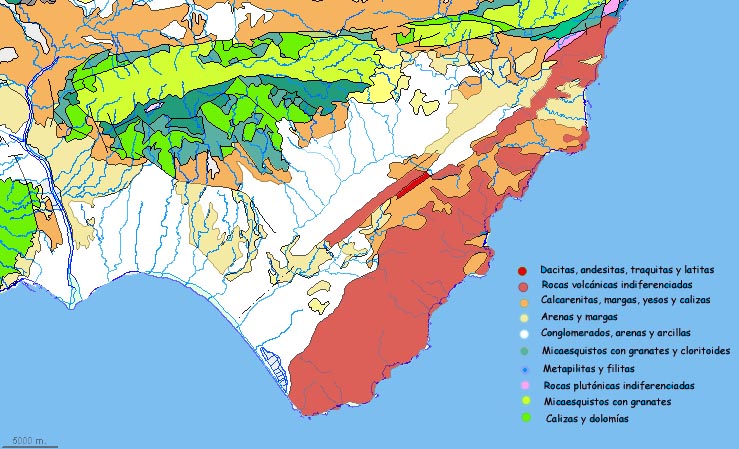
– MAPA Y CORTE GEOLÓGICO.
– LA SIERRA DE CABO DE GATA: VOLCANES Y ARRECIFES.
 almeriense.
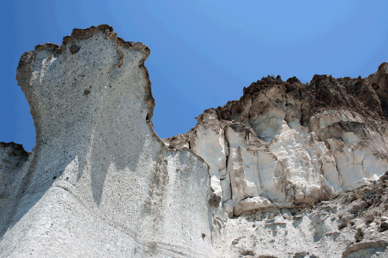
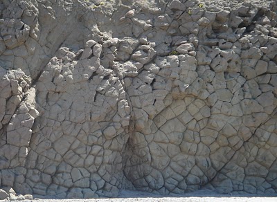
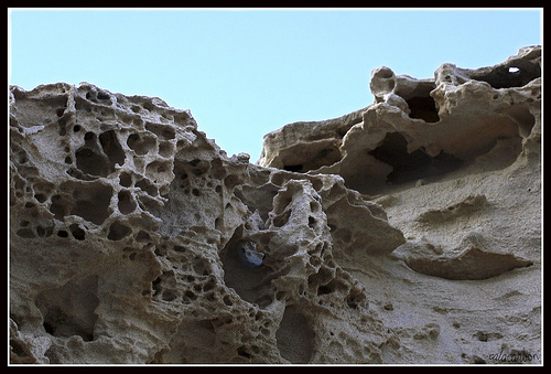
 El magma afloró a la superficie generando numerosos edificios volcánicos, submarinos en su mayor parte, favorecido por la debilidad de algunos grandes accidentes tectónicos, como la gigantesca falla de Carboneras o de la Serrata. Estos edificios volcánicos son, en muchos casos, reconocibles en el paisaje de Cabo de Gata, ya que siguen siendo los cerros elevados, mas o menos cónicos de al zona: Los Frailes, Mesa de Roldan, Cerro de los Lobos, La Tórtola, etc. Abundan mucho las rocas volcánicas brechoides (formadas por fragmentos de diferente composición o aspecto) que son el resultado de diversos procesos volcánicos: enfriamiento diferencial de distintas partes de la colada de lava, explosiones, nubes ardientes, avalanchas por las laderas de los volcanes, etc.
En un clima global cambiante, la región paso por épocas cálidas y mas frías. Algunos edificios volcánicos llegaron a emerger como islas, configurando un extenso archipiélago. En un mar cálido, tropical (por encima de 20ºC) , se desarrollaron arrecifes de coral a modo de atolones o de arrecifes costeros. Estos arrecifes de coral fósiles, como los de Purchena, Cariatiz, Níjar, Mesa de Roldan, etc., son de los mejores ejemplos que existen en el mundo.
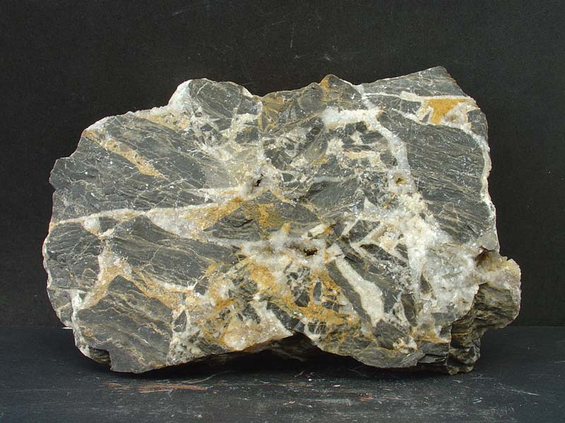
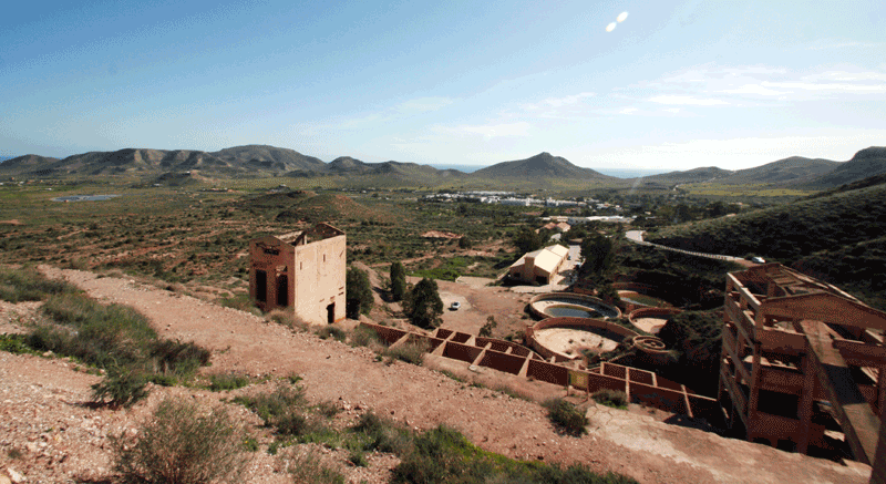 Ademas, la circulación de agua marina a través de las rocas y el calor liberado por el magma permitió la formación de fluidos calientes (hidrotermales) que generaron exclusivos yacimientos minerales, como el de oro de Rodalquilar. El Parque alberga dos importantes complejos arqueo – industriales de carácter minero: las instalaciones mineras de Rodalquilar y el embarcadero de mineral de Aguamarga.
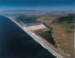
– LA BAHÍA DE ALMERÍA: DUNAS, ALBUFERAS Y PLAYAS FÓSILES.
Libro publicado por la Consejeria de Medio Ambiente de la Junta de Andalucía.